
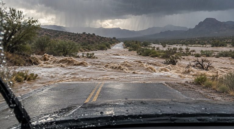

LAS CRUCES – A flood watch is in effect for Las Cruces and all of Doña Ana County through early Wednesday morning as forecasters warn that repeated rounds of heavy rain could flood streets, arroyos and low-water crossings.
The National Weather Service expects showers and thunderstorms to increase Monday afternoon and continue through Tuesday night. Tropical moisture moving north ahead of the weakening Tropical Cyclone Polo is contributing to the unusually heavy rain threat. Some locations across southwest New Mexico could receive as much as four inches of rain if storms repeatedly pass over the same area.
In Doña Ana County, the watch includes Las Cruces, the Mesilla Valley, Hatch, Radium Springs, Vado and Sunland Park. The Weather Service warns that runoff could cause streams and rivers to rise and flood low-lying areas. Rain from last week has already saturated some ground, leaving less room for additional water to soak in.
The danger is not limited to places where rain is falling at the time. A storm upstream can send fast-moving water through an arroyo or across a road miles away. Drivers should never enter a flooded crossing, even if they have used that route many times before. The depth of the water and the condition of the road beneath it may be impossible to judge.
The flood threat extends well beyond Doña Ana County. Watches cover much of New Mexico, from the Four Corners and the Rio Grande Valley to the eastern plains and southeast. Forecasters expect many areas to receive one to three inches of rain through Wednesday, with higher totals possible where the heaviest storms develop. The location of those storms remains uncertain.
Parts of the state have already experienced flooding this month. Emergency management reported flash flooding around Ruidoso on Sept. 16. Flooding along the Rio Bonito from Lincoln toward Hondo prompted evacuations and a flash flood emergency on Sept. 24. Those recent events underscore the risk where heavy rain falls on saturated ground or wildfire burn scars.
A flood watch means flooding is possible. Residents should keep a way to receive weather alerts, avoid arroyos and streambeds during storms, and be prepared to move to higher ground if a warning is issued. The threat may continue into Wednesday morning as runoff moves through area waterways.
John Krehbiel – Bravo Mic Communications News, LLC – John@Bravomic.com
KXPZ 99.5 FM Zia Country- Real Country